Constitution of board

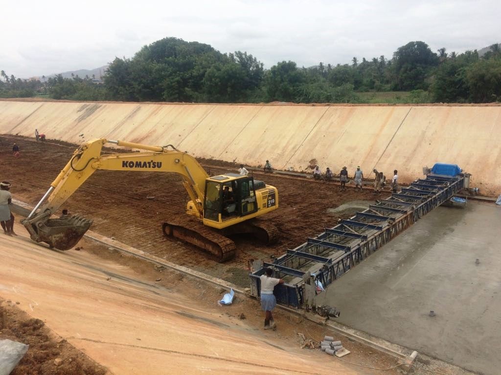
The Tungabhadra project was taken up by then states of Madras and Hyderabad during February 1945. With the formation of Andhra State Act 1953, certain areas of the project of the right side of the river belonging to the then madras state were transferred to the then Mysore state and the project became a venture of the then states of Mysore, Andhra. This resulted in more than 55 percent of irrigated area on the right bank of the river falling in Andhra & the reservoir with the head reaches of the canal system lying in the state of Mysore .This situation warranted constitution of an independent body to look after the timely completion of the approved project, its maintenance and oversee distribution of benefits to the states.

Subsequently ,as per the Andhra State Act,1953,President of Indian was authorized to give directions for the completion of the project and its operation and maintenance there after .Accordingly, Under a presidential order, Tungabhadra Board was constituted with effect from 1st oct,1953 vide notification No DW II -22(129) Dated 29 th sep,1953 of the then ministry of irrigation and power.

The Board constituted of chairman appointed by government of India & six members were chief engineers of both irrigation and power department of the government of Andhra, Mysore and Hyderabad .Chairman of the central water And power commission was appointed the chairman of the board in addition to his normal duties .The board was entrusted with the task of completion of the Project and to deal with all matters relating to works, which were common to both the states of Andhra and Mysore.

The board was reconstituted with effect from 15 march, 1955 vide notification No DW VI (4) (9) Dated 10-3-1955 of the then Ministry of irrigation and power (copy at Annexure 2.1).The reconstituted Board consisted of a chairman appointed by the government of India, Andhra, Mysore and Hyderabad. After the reorganization of the states in 1956, the Hyderabad Government representative was deleted from Board vide Notification Np.39(25)/56 DW .VI dated 1.11.1056 of then ministry of irrigation and power.

Earlier the center line of the Tungabhadra River was the boundary on then states. With re-organization of states, the center line of river no more remained the boundary and the canal on the right bank meandered through the states of Andhra Pradesh and Karnataka

Present Composition Of Board
The present composition of the Tungabhadra Board is as follows:

Present Composition Of Board
Chairman(Nominated by GoI) Chief engineer, Krishna & Godvari Basin, central water commission, Hyderabad
Member (Representing GoI) Finical Adviser and joint Secretary ,Ministry of water Resources, New Delhi
Member (Representing GoAP) Engineer-in-chief, (Irrigation),Irrigation & CAD Dept., Hyderabad
Member (Representing GoT) Engineer-in-chief, (Irrigation),Irrigation & CAD Dept., Hyderabad
Member (Representing GoK) Secretary to government, Water Resources Department, Government of Karnataka, Bangalore.

Chairman:
Shri P.Ramachandra Rao,
Chairman,Tungabhadra Board and Chief Engineer(KGBO),
Central Water Commission,
H.No.11-4-648,
K.G.Bhavan,A.C.Guards,
Hyderabad.

Member of Government of India
Shri Sunil Kumar Kohli

Member of Government of Andra Pradesh :
Shri Aditya Nath Das

Member of Government of Karnataka
Shri B.G.Guruparaswamy

Function of the Board

The important functions of the Board, initially laid down were:

Completion of the construction of the sanctioned project;
Regulation of supplies of water and power in accordance with such rules as may be made in this behalf by the Board;
Maintenance of canals and other works common to both the states of Karnataka And Andhra Pradesh;
Maintenance of the dam and Reservoir of the project;
Granting of lease of fisheries in the reservoir in the canals:
Proper utilization of land acquired for the purpose of the project; and
Any other function incidental to or connected with the function specified in above clauses.

In the discharge of its assigned functions, the Board exercises power of state Government .Board makes its own rules for the conduct of its own business .The Board appoints a whole time secretary
Tourism

PARKS AND GARDENS

Since completion of the dam, the Board has developed and maintained many gardens and parks, downstream of the dam and in the colonies. The gardens near the dam are attracting many tourists.
Aquarium

Nandanavana Garden
Japanese Park
Deer Park
Birds Aviary
Children Park
Vaikunt Guest House Garden
Circular Park and Triangular Park

Nandanavana Garden

Nandanavana garden was developed soon after the completion of the dam during the year 1956-57. Thisgarden is located just downstream of the dam running parallel to it. It has an area of about 6 acres (2.43 ha) and is designed and developed on the lines of Brindavan Gardens at Krishna Raj Sagar near Mysore. It is well laid with four terraces at different elevations. The first terrace is housing circular type fountain with a Shiva statue at the center. The other three terraces are equipped with fountains of various designs, running parallel and perpendicular to the layout of the garden. This garden has got welll-maintained lawns, Bougain villea on the slopes, seasonal and annual flower beds, Christmas trees, Cyprus plants and topiary arches.

Japanese Park

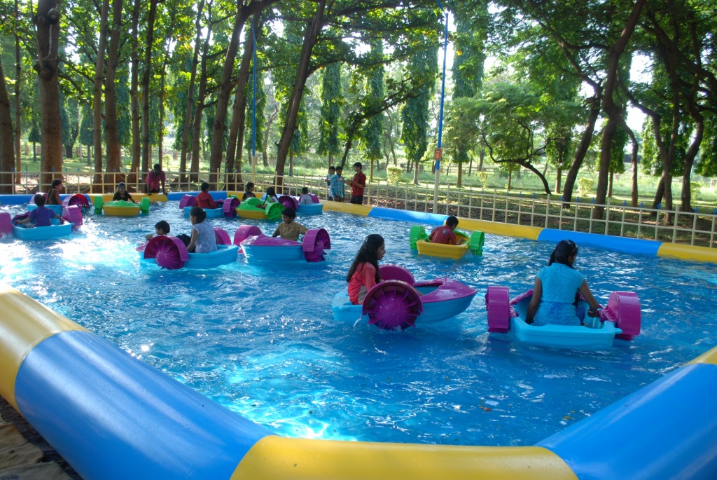
Japanese Park was developed in the year 1968-69 with a total area of 18 acres (7.29 ha) and is located adjacent to Nandanavana garden. It has got 3 water ponds, namely mango shaped pond, bean shaped pond and children peddle pond which were constructed after 1970. This park has arches, ornamental flowering trees, flowerbeds, etc. A musical dancing fountain was added to the garden in the year 1994 which provides added attraction for visitors. An aquarium was constructed within the garden to provide further choice of entertainment and education for the visitors.

Deer Park

The Deer park is located just by the side of Japanese park. It was developed in the year 1982, with anapproximate area of about 15 acres (6.07 ha). At present , it has got about 70 spotted deer’s, 4 sambars, 4 neelgai, 6 black bucks, 1 chinkora, 30 rabbits and 2 porcupines.

Birds Aviary

A small aviary is housed in the complex of Deer park and was developed in the year 1989. Presently, it has got about 200 pigeons, 4 peacocks, 15 guinea fowl and 10 parrots.

Children Park

Children Park is located in the township area of TB Dam on the main road, and was developed during 1984. It has got latest type of sea-saws, bars, swings and other items for children. The park is exclusively meant for children below 12 years.

Vaikunt Guest House Garden

Garden at Vaikunt Guest House was developed during the year 1960-61. It is a formal garden with well designed fountains, flower bed, topiary arches, flowering trees etc.
Photo vaikunt and garden.

Circular Park And Triangular Park

A Circular Park and a Triangular Park is located just in front of the Administrative building. It was developed at the time of construction of dam. It is also a formal garden with lawns, flowering trees, shrubs, arches etc.
HYDRO-ELECTRIC WING

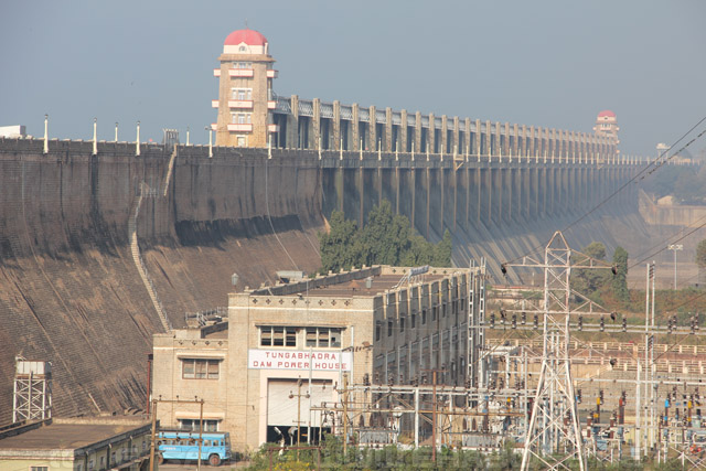
Although primarily intended as an Irrigation Project, the impounded water in Tungabhadra Reservoir is also utilized to generate power before being let out into the canals for irrigation purpose. The power generated on the left side is entirely used by Karnataka while that generated through two power houses on the right side is shared by states Karnataka and Andhra Pradesh in the ratio of 20:80. One Power House is at the foot of the dam and another at Hampi, 21Km from the dam. The Scheme of generating electricity at these two powerhouses is called “Tungabhadra Hydro Electric Scheme”(TBHES). Work on Dam Power House was taken up in 1951 while that on Hampi power house in 1956. These power houses were commissioned in 1957 and 1958 respectively.

Dam Power House

Dam Power House is located at the foot of the dam. The gross head available at dam powerhouse for generation of power varies from 13m to 26.8m (43ft to 88ft). The four turbines are connected with four steel penstocks, each of 3.3m (11 ft) dia, to the reservoir through butterfly valves. In the first stage, two units each of 9 MW were commissioned on 23rd May 1957 The two units each of 9 MW of second stage were commissioned on 26th February 1964 and 17th June 1964. The total installed capacity of Dam Power House is 36 MW.

The main objective of the project being irrigation, electricity generation is dependent on the water releases made for irrigation requirements in the RBLLC and river assistance to RDS and KC Canal. Water releases vary from time to time as per irrigation demands furnished by the states. During rainy season, especially when the reservoir is nearing 1633ft or isoverflowing, full generation of 36 MW is feasible at the dam  power house drawing water at the rate of 5,600 cusecs (153 cumecs) with maximum differential  head of 88 ft.(26.8 m).

Hampi Power House

Hampi Power House is fed from the tailrace water from dam powerhouse through the Power Canal. A fore bay is located at the end of this canal which has a  storage capacity of 26 Mcft(0.74 Mcum) with normal level of  463.1 m (1,519 ft). The intake structure at forebay has gates, hoists and trash racks. There are two low pressure steel pipe lines (LPPL) each of 5.48m dia (18 ft) and 868.3m in length carrying discharge from forebay to the power house. At the end of each LPPL there is a steel differential surge tank with 18.3m (60 ft) dia and 18.3m (60 ft) in height. There are four penstock pipes each 3.66m (12ft) dia with a maximum discharge capacity of 1,100 cusecs (31.15cumec) two from each of the surge  tanks, installed and connected  independently to each turbine in the power house.Each penstock is provided with a 3.66 m (12ft) butterfly valve, an air valve at surge tank end and 3.05 m (10 ft) butterfly valve  and venturimeter at power house end.

The first unit of 9 MW was commissioned on 10th February 1958 and the second unit of 9MW on 26th March 1958. The remaining two units, each of 9 MW, were commissioned in April and July 1964.

The total installed capacity of Hampi Power House is 36 MW. After generation of power at the Dam Power House water is led into the Power Canal. The discharge carrying capacity of the Power Canal is limited to 2,500 cusecs (70.79 cumec) and hence maximum generation at Hampi Power house is limited to 20 MWs against an installed capacity of 4 x 9 = 36 MW. The generation at Hampi powerhouse is dependent on  water discharge through Power Canal. The water discharged from Hampi powerhouse is led into Low Level Canal and is allowed through Gundlakeri escape in case of demand for river assistance.

SHARING OF POWER

The power generated at both the power houses is to be shared in the ratio of 80:20 between  Government of Andhra Pradesh and Government of Karnataka.

Tungabhadra Reservoir

Water Management in a reservoir, among others, calls for a fairly accurate assessment of the capacity of the reservoir to store water at various levels. Tungabhadra Reservoir with a drainage area of 28,180 sq.km was designed for storing 133 TMCft. of water and was impounded for the first time in the year 1953. The full reservoir level (FRL) was fixed at RL 1633 ft. Capacity of the Reservoir at various levels was worked out based on the regular contour survey conducted in the river basin upstream of the Dam prior to the impounding of water in the reservoir. The survey was conducted with a contour interval of 10 ft and the capacity of the reservoir computed for every one-foot interval. According to this the Gross capacity of Tungabhadra Reservoir was taken to be 133.0 TMCft., (3766.1 M.cum) at an FRL of 1633 ft. (497.738M).

FISHERIES

The Board has set up a fish farm for producing quality seeds for raising bio mass in available water bodies located in the states of  Karnataka and Andhra Pradesh. A part of the seeds so produced are stocked in the reservoir to enhance the fishery  wealth of the reservoir. In addition, to facilitate preservation of fish catch, Board is running an Ice-cum-Cold Storage Plant  for the  convenience of the fishermen of the area. The Board has also established a Fish Net Making  Plant to manufacture and supply quality fishnets to the fishermen.fish3

FISH FARM UNIT

The Fish form Unit  was setup in the year 1959 in an area of 8.10 ha (20.25 acres). This farm is having earthn ponds of different size ranging from 17m x16m to 94m x 38m and 125 cement ponds of size ranging from 3 x 2 m to 24 x 12 m (10.0 x 6.6 ft to 80.0 x 40.0 ft). A glass jar hatchery unit with a capacity of hatching 50,00,000 eggs per day was commissioned in 1982.

The salient features of Fish Farm Unit are detailed below:

1 Total water spread area of Fish Farm 4.70 ha (11.75 acres) area of Fish Farm
2 Stock ponds area   2.29 ha ( 5.73 acres)
3 Rearing ponds 2.15 ha ( 5.44 acres)
4 Nursery ponds 1.00 ha ( 2.50 acres)
5 Water supply ponds 0.13 ha ( 0.33 acres)
6 Breeding and hatching ponds 0.13 ha ( 0.33 acres)
Fish Farm UnitEvery year Fish Form Unit is producing spawn of major carp, common carp and Chinese carp, utilising the parent stock  (brood stock) raised in fish farm by hypophysation technique. This method induces the fish to release eggs in stagnant water by injecting pituitary hormone which was first introduced in the unit during 1962-63. The spawn so produced, apart from rearing further to fry stage and then to fingerling tage for supply, are disposed off at spawn stage also. The FFU is a leading producer of catla fish seed which is in great demand in the region. It is ideal in respect of its location, design, maintenance of  breeders, hatching facilities etc. The fisherman of the area have great faith in the quality of seeds provided by the FFU. Many undergraduate and postgraduate Students of Zoology from various colleges of the State  Karnataka  and neighboring State of Goa pay visit to the FFU every year as part of their practical training in fish culture and breeding aspects. The unit provides good quality of seeds to the farmers in the area who decide to take up fish rearing for additional income at very competitive prices.
ICE-CUM-COLD STORAGE PLANT UNIT
Ice-cum-cold Storage UnitFish is a highly perishable commodity. Its preservation soon after its catch from the water is essential. Icing the fresh fish is the simplest preservation method. In order to meet the ice demand of the fishermen, 5 Tonne capacity Ice Plant was set up in the year 1966. At the same time a 10 tonne capacity cold storage plant was also established. As there is no demand for cold storage space, the plant is idle now. Another ice  plant of 10 tonne capacity was set up in the year 1986 which is presently functioning and ice is being marketed  throughout the year with peak season falling between February to May.

IRRIGATION WING

IRRIGATION WING
The Irrigation Wing (IW) of the Board is in-charge of maintenance of right half of the main dam, whole of the reservoir, Right Bank HLC and Right Bank LLC up to Board’s limit. The Low Level Canal also includes Power Canal and certain common distributories. The total areas localised for irrigation under the project both on right bank and left bank including areas in Karnataka and Andhra Pradesh is 4.899 lakh ha (12.1 lakh acres)(as per project record) excluding the schemes benefited with the assistance of water from Tungabhadra reservoir. The irrigation benefits under each canal/system of the project are given at Annex 2.6
ORGANISATIONAL SETUP
Irrigation Wing is headed by a Chief Engineer,(part-time) who belongs to Irrigation Department of  Government of Karnataka Chief Engineer, Irrigation Central Zone (ICZ), stationed at Munirabad is normally deputed by Government of Karnataka to act as Chief Engineer of the Board in addition to his normal duties in ICZ. There is one post of Superintending Engineer, which is filled up by an Officer from I & CAD Department of Andhra Pradesh. There are two Divisions – one at Tungabhadra Dam is filled by an officer from Karnataka and the other at Bellary is headed by officer from Andhra Pradesh. All the other officers and staff are drawn from the Irrigation Departments of Government of Andhra Pradesh and Government of Karnataka on 50:50 basis.  Irrigation Wing is given the following responsibilities.
Photo of canal taking off from Dam
  • to effect reservoir operation in all seasons for efficient irrigation management in accordance with the approved working table including flood management and dam safety.
  • to supply quantities of water as per the indents placed by Government of Karnataka and Government of Andhra Pradesh for right bank canal systems, and river assistance as per Krishna Water Disputes Tribunal award
  • to effect supplies at the distributory heads of the HLC and LLC as per the indents given by Government of Karnataka and Government of Andhra Pradesh up to Board limit
  • to deliver specific discharges at Board limits of HLC and LLC on the right side
  • to render the water account of the reservoir and all canal systems including collection of daily drawal data for the systems on the left side from Government of Karnataka; and
  • to effect supply of water for the hydro electric power generation on the right side through power houses at Tungabhadra dam and at Hampi.
Krishna Water Dispute Tribunal Award
Water Regulation
Negative Inflows into the Reservoir
Year wise Utilisation of Water
Drinking Water Demands
Industrial Water Demands
Problems in Water Regulation
Flood Management
KRISHNA WATER DISPUTE TRIBUNAL AWARD
The KWDT award stated that the Board would continue to prepare the working table for utilization of the water of the reservoir and regulate the sharing of water between states of Karnataka and Andhra Pradesh as per the allocations made in the award and in accordance withsuch rules as may be made in this behalf by the Board.
The details of allocations as per KWDT award are given below:
Unit:TMCft.
Canal System Karnataka AndhraPradesh Total
1. Right Bank Low Level Canal (RB LLC) 19.00 24.00 43.00
2. Right Bank High Level Canal (RBHLC) 17.50 32.50 50.00
3. Left Bank Low Level Main Canal +Left Bank High Level Canal  (LBMC + LBHLC) 93.00 93.00
4. Raya and Basavanna Channels (RBC) of the State   of Karnataka 7.00  7.00
5. Assistance by way of regulated release to Vijayanagar Channels(VNC) other than RBC. 2.00 2.00
6.  Assistance by way of regulated release to KC Canal  (KCC) of the State of AP. 10.00 10.00
7. Assistance by way of regulated release to Rajolibanda Diversion Scheme (RDS) 0.49 6.51   7.00
 Total 138.99 73.01 212.00
 Reservoir Evaporation losses (Ratio 12.5 K: 5.5
AP)
12.50 5.50 18.00
Grand Total
 151.49  78.51  230.00
Photo of  irrigation
WATER REGULATION
Irrigation Wing of the Board is responsible for the water regulation of RB HLC and RB LLC and to keep water account of the sluices, transmission and system losses etc. The water regulation of left bank canals, namely, Left Bank Main Canal and High Level Canal (LBMC+ HLC), is entirely with Irrigation Department of Karnataka. Officials of the Board, however, collect the data from these canals to enable them to render water accounts. They also have access to the details of daily drawals of LBMC and HLC for verification of drawals. Utilisation of water in the command area of the project is under the control of respective State Governments and the Board has no jurisdiction on the regulation of water beyond the off take points of the distributories along the two main canals on the right side, except the common distributories.
In order to assist the Board in distribution and regulation of water in various canal systems of the project, a Review Committee at the level of Superintending Engineer has been constituted. The committee is headed by Superintending Engineer Irrigation Wing, of the Board and represented by the same level of officers from each of the States of Andhra Pradesh and Karnataka. At the beginning of a water year, the Review Committee assesses, the water availability for the year based on historical data using the criterion of 75% dependable flows. The committee considers the water position as existing, and also considers the indents of the participating states through each of the canal systems and prepares a Draft Working Table, keeping in view the entitlement of water for each canal system as per KWDT award, for operation and regulation of water for the entire water year. The Draft Working Table is approved by the Board and serves as operation schedule to the extent possible. Periodically, the Committee reviews the performance of the reservoir, and re-assesses the availability of water. If necessary, the working table is modified based on re-assessed water availability and also the revised pattern of drawals indicated, if any, by the participating states.The Board considers the recommendations of the committee for according approval.
Right Bank High Level Canal.
The Right Bank High Level Canal (RB HLC) is designed for carrying a discharge of 113.27 cumecs (4000 cusecs) at head. This is a lined and seasonal canal envisaged to cater to the supplemental irrigation needs from 15th July to the middle of December. The sill level of HLC sluices is 483.10 m ( + 1585 ft.) which is higher than sill levels of all other canal systems. The total length of the canal is 196.43 Km and jurisdiction of the Board is restricted upto 105.487Km i.e., Karnataka State border. Within the Board’s limit, in the Karnataka area, there are 26 direct off take sluices in HLC to cater to the needs of 80,939 ha (1, 99,920 acres) of ayacut in state if Karnataka. The canal further serves an area of 76,927 ha (1, 90,035 acres) in State if Andhra Pradesh. 4.5.4 As per KWDT Award 1415.84 Mm3 (50 TMCft) of water is allocated to HLC out of an allocation of 6003.17 Mm3 (212 TMCft) to Tungabhadra Project. Further distribution of HLC water between State of Karnataka and Andhra Pradesh is in the ration of 35:65. Thus the allocation of water under HLC for State of Karnataka is 17.5 TMCft and for State of Andhra Pradesh 32.5 TMCft. However, due to lesser utilization of water under the project in last ten years, average availability of water for HLC has reduced. The actual average drawals including diversion from other systems to HLC during the last ten years have been 16.744TMCft for State of Karnataka and 29.282 TMCft for State of Andhra Pradesh respectively.
Right Bank Low Level Canal.
The Right Bank Low Level Canal is designed for carrying a discharge of 50.97 cumecs(1,800 cusecs) at head and 20.53 cumecs (725 cusecs) at Board’s limit. The total length of RB LLC is 348.2 km out of which the Board is incharge of 250.58 km. Before finally entering in the State of Andhra Pradesh the RBLLC is meandering both in State of Karnataka and Andhra Pradesh in short length as detailed below.
LLC Photo Hydralics head
—————————————————————————————
Canal Reach in Karnataka                            Canal Reach Andhra Pradesh
territory (Km)                                             territory(Km).
—————————————————————————————
0.000 to 131.500                                              131.500 to 135.700
135.700 to 147.800                                              147.800 to 148.000
148.000 to 156.000                                              156.000 to 188.000
188.000 to 190.800                                              190.800 to 250.580
———————————————————-
RBLLC usually runs for ten months in a year and is generally closed in May and June months for maintenance works. This was an unlined canal to begin with in entire length. Subsequently, lining of the canal was taken up in a phased manner in identified vulnerable reaches in order to improve the efficiency of the canal. It has 92 direct off-take points upto the Boards limit. Further, there are 11 common distributaries (Annex4.1) running about 91 km and serving ayacuts of both the States. RBLLC serves an ayacut of 37,518 ha (92,670 acres) in the state of Karnataka and 63,588 ha (1,57,062 acres) in Andhra Pradesh.
As per KWDT award the water allocated for RBLLC for the states of  Karnataka and Andhra Pradesh is19.0 TMCft and 24.0 TMCft respectively, which is exclusive of prorata reservoir evaporation losses of 3.5 TMCft and 5.5 TMCft respectively. Due to lesser utilization of the water from the project, water availability during the last ten years has reduced. Accordingly, the actual drawals in the canal have been 17.19 TMCft for Karnataka and 18.90 TMCft to Andhra Pradesh respectively.
System losses
Whenever pipings or breaches occur in the canals a certain quantum of water is allowed to flow through the escapes to deplete the water level at the piping/breach site quickly, to take up repairs. Certain amount of water also flows through the breaches whenever they occur. Board in its 130th meeting held on 29-01-1988 being aware of the water losses due to certain unauthorised drawals by various means and noting that the law enforcing authorities are not able to effectively prevent/control these unauthorised drawals, permitted to make provision for these losses, termed as system losses. This is in addition to the usual provision of transmission losses. In respect of RBLLC the Board permitted to account a maximum of 120 cusecs as system losses from the water year 1987-88. Similarly during the 165th meeting the Board permitted to account for a maximum of 120 cusecs as system losses in RBHLC also with effect from 1998-99.
Water account
The daily reports indicating the performance of reservoir, 10 day drawal account, and the details of drawals under each canal system by both the states are sent by the Board officials and to all concerned authorities of Government of Karnataka, Government of Andhra Pradesh  and Government of India regularly.
YEARWISE UTILISTION OF WATER.
The Krishna water Disputes Tribunal (KWDT) has allocated 212 TM cft of water for Tungabhadra Project for irrigation utilization excluding reservoir evaporation losses. The year wise actual irrigation utilization for the last 23 years is given in Annex 4.2 The utilization of water was maximum during the year 1992-93, at 139.269 TMCft by Karnataka and 72.717 TMCft by Andhra Pradesh, totaling to 211.986 TMCft. This was due to unprecedented floods which occurred in the month of November1992, thereby replenishing the reservoir to its full capacity. Drawals of water from the reservoir by the States of Karnataka and Andhra Pradesh through different canal systemsfor the water year 1993-94 to 1998-99 as against allocations made in KWDT are given at Annex 4.2. It  is observed that utilization in the project is far below the water allocated to the project. Main reasons for lesser utilization are
Photo Hydrographic
  • reduction in the storage capacity of reservoir due to progressive siltation
  • realisation of lesser inflows than estimated during the period from December to April, and
  • Late arrivals of inflows at the beginning of the water year resulting in delay in the opening of canals and thereby lesser utilization in Khariff season in the Pre-surplussing and surplussing period upto November.
The utilization of water is directly proportional to the inflows realised in the reservoir with their time distribution and the climatological conditions during the water year.The problem of shortage of water for the authorised ayacutdars has aggravated as some farmers are also violating the cropping pattern and drawing more water than permitted by forcibly operating the sluices
The unauthorised tapping of water in the command is generally by one of the following methods.
  • by damaging the regulating mechanism
  • by syphoning through pipes to feed the areas out side the localised ayacut and lying close to and along the canal
  • by laying pipes hidden under the embankments
  • by damaging the escape shutters and taking water to further patches of land all along natural drainage courses;
  • by cutting the canals and
  • by  perforating holes in the bed of canal and cross drainage structures
DRINKING WATER DEMANDS
While extending irrigation benefits to the command area of the project through a net work of canal systems,the demand for drinking water is being met with. Year after year such demand is increasing due to population growth for the towns such as Raichur in Karnataka on the left bank, and Bellary in Karnataka, Adoni, Alur, Kurnool and Anatapur towns in Andhra Pradesh on the right bank situated nearer to the canal systems. Demands are coming in for drinking water supplies for other towns and groups of villages through the respective Governments, for consideration of the Board. Board permits these drawals out of the respective irrigation water quota of the two states. A list of drinking water schemes sourcing their requirement from various systems of the project are given in Annex-4.6
Photo water filters house
INDUSTRIAL WATER DEMANDS
Due to overall economic development of the area on account of benefits accrued from the project, many industries are coming up in the command areas and in the areas near the dam. Demand for water from the project for industrial purposes too is increasing. These demands are met out of the allocations by the respective states, by adjustments of irrigation requirements within a State. A list of industries drawing water for industrial use from various systems of the Project as approved by the Board from time to time are given in.
PROBLEMS IN THE WATER REGULATION
Sometimes, the field staffs on patrolling duty are facing problems of man handling from the miscreants when mobs of ryots resort to illegal actions such as forcible excess drawals through sluices by damaging the structures or tap water by various illegal means. Staff members resenting against such man handling are resorted to strikes on certain occasions. Police complaints  are promptly being lodged on all such offences. The Board has to depend upon the local police only for all security arrangement, whenever water regulation problems arise.
FLOOD MANAGEMENT
Photo Spill way gates opened full
The flood management of the reservoir is one of the main functions of Irrigation Wing. As planned, the live storage capacity of the reservoir has no provision for flood absorption. The entire flood impinging on the reservoir has to be either stored in it to the extent possible allowing discharge into power houses for maximum power generation or passed over the spillway. For this purpose the spillway with 33 gates is designed to allow a maximum discharge of 18,406 cumecs (6,50,000 cusces) at Full Reservoir Level of 1633ft. The operation of spillway gates is carried out in accordance with approved schedules duly ensuring the dam safety.
Central Water Commission provides daily information about the flood inflows and rainfall occurrence at
  • Thirthahalli on the Tunga river,
  • Harlahalli on the Tungabhadra river and
  • Marol on the Varada river.
Based on the flood observed on these upstream stations, and the incidence of rainfall, the probable flood expected at the dam is assessed by the CWC authorities and communicated to the project authorities over wireless sets to enable the operation of spillway gates. Inflow forecasts provided by CWC are fairly accurate and useful but in certain cases, due to contribution from the un-gauged lower catchment the project authorities are caught unaware.However, based on these inflow forecasts efforts are made to moderate the inflow peaks by judicially creating storage in the reservoir through advance depleting. The concerned Irrigation, Revenue and Police authorities are alerted in advance about the flood releases to be made from the reservoir to enable them to make necessary advance arrangements all along the river, downstream of the dam, to ensure safety of the public and properties. The information about release of discharges is also passed onto All India Radio and Door Darsan for wide publicity.
The peak flood received in the reservoir and discharged over the spillway during the last six years is given in the table below.
Year
Peak hourly
inflow
Peak hourly
outflow
Date
 1993-94
2,02,187 
2,01,911
18-10-93
1994-95
 2,70,825
 2,70,340 
17-7-94
1995-96
1,00,281
No spillage
 1996-97 
1,08,650 
1,08,190 
4-9-96
1997-98
1,85,279
1,84,992
8-8-97
1998-99
1,20,431 
1,20,008 
15-9-98

Tungabhadra River

The River Tungabhadra derives  its name from two streams viz., the  Tunga, about 147 km (91.6 miles) long and the Bhadra, about 178 Km (110.9 miles) long which rise in the Western Ghats. The river after the influence of the two streams near Shimoga, runs for about 531 Km (330 miles) till it joins the river Krishna at Sangamaleshwaram in Andhra Pradesh. It runs for 382 Km (237 miles) in Karnataka, forms the boundary between Karnataka and Andhra Pradesh for 58 Km (36 miles) and further runs for the next 91 Km (57 miles) in Andhra Pradesh. The total catchment area of the river is 69,552 Sq Km (26,856 Sq miles) up to its confluence with Krishna and it is 28,177 Sq Km (10,880 Sq miles) up to Tungabhadra Dam. It is influenced chiefly by the South-West monsoon. It is a perennial river but the summer flows dwindle to as low as 2.83 to 1.42 cumec (100 to 50 cusec).